News
New mapping technology gives land managers another tool to protect landscapes and make the most of carbon trading offsets
Planned high-resolution satellite mapping will help land managers reduce bushfires and increase carbon-offset income for communities in the Northern Territory.
The Earth observation product will be developed with $97,000 funding from the Northern Territory Government and technical support from Geoscience Australia through the EO4NT grant program.
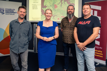
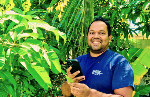
Charles Darwin University (CDU) spatial software engineer Dr Patrice Weber who leads the project said the North Australia Fire and Rangeland Information service (NAFI) will be developing new software to acquire high-resolution satellite images and apply sophisticated mapping algorithms to identify burnt areas.
“This mapping will greatly improve risk mitigation planning and operational response for bushfires that impact agencies and businesses in the NT,” Dr Weber said.
CDU researcher Dr Rohan Fisher said the new maps would be a tool to improve land management, and to reduce risk from wildfire for remote communities.
“There are many Indigenous-led businesses that have been created because they protect and manage their land for the benefit of everyone,” he said.
“It’s the backbone of the carbon economy. When putting value in our natural resources and ecosystems we are also giving communities the tools to manage their own lands and commercial opportunities.”
Dr Fisher said the grant would help to improve fire management, which helps to increase income for the communities.
“Our clients are wide-ranging and work in industries including agriculture, pastoralism, defence, police, Aboriginal rangers, landowners and government services. The product that this grant makes possible will likely attract new customers, including from the carbon emission abatement industry and fire management proponents,” Dr Fisher said.
Minister for Industry, Nicole Manison, said the EO4NT grant helps support important projects such as those being undertaken by CDU.
“This technology will help business, industry and government to make critical decisions on issues such as bushfires and their impact on our community,” Minister Manison said.
“The EO4NT grant recipients like CDU demonstrate the enormous potential for Earth observation-derived business and industry solutions to grow and thrive in the Territory.”
Related Articles
Rooting out plant diseases: Are computers ready to run our farms?
Nature is still too complex for artificial intelligence (AI) modelling to be effective, but the tipping point is close, according to a new study that found the technology may still trip at the last real-world hurdle.
Read more about Rooting out plant diseases: Are computers ready to run our farms?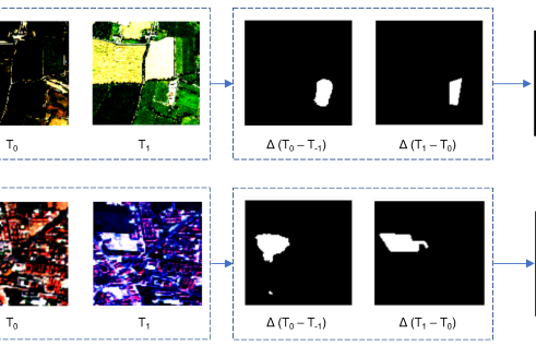
Tech on the treetops: How AI can protect forests
The Artificial Intelligence model was developed to detect changes in forest cover.
Read more about Tech on the treetops: How AI can protect forests
Volunteers protected Darwin wildlife for 50+ years, but new research suggests it’s time to stop winging conservation efforts
Volunteers have shouldered the burden of shorebird conservation in the Top End for more than half a century, but new research from Charles Darwin University (CDU) suggests it’s time for the government to take responsibility for all of the Northern Territory’s residents – including those with wings.
Read more about Volunteers protected Darwin wildlife for 50+ years, but new research suggests it’s time to stop winging conservation efforts


